blah blah blah
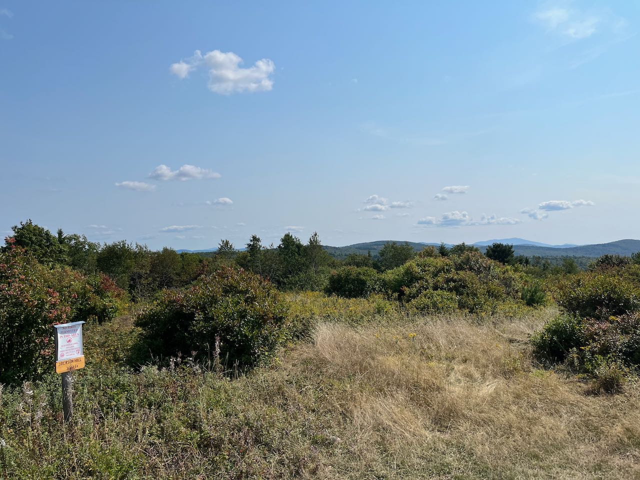
Jackson Hill
Length: 4.1 miles out-and-backDifficulty (click for info): Easy
Elevation Gain: 660 feet (+390 feet on return)
Rating (click for info): 6/10
Elevation: 2060'
Prominence: 177'
Driving Directions:
Trailhead and parking area are at the end of King Street in Washington, NH. From Rt. 31 in the center of Washington, across from the church and town offices, drive west from the triangle junction on Faxon Hill Road. Go 2.0 miles, and as the road swings right, turn left onto King Street. Proceed 1.5 miles down this rather narrow dirt road to the end of the driveable portion, where the road becomes class 6. Park in the pull-off on the right side. Click here for a Google map.
About the Hike:
Located on the Sullivan/Cheshire county line in a cluster of rolling hills on the west side of Highland Lake, Jackson Hill is one of the many points of interest on the long-distance Monadnock-Sunapee Greenway. Offering panoramic views from a picturesque meadow baring its summit, Jackson is one of many low hills and mountains that would be of no significance without that moderately famous backpacking trail, which runs between the two mountains its name suggests. The greenway provides a nice half-day hike with a few scenic stops along the way that is an alternative to the busier Pitcher Mountain fire tower, located to the south in the same group of hills.
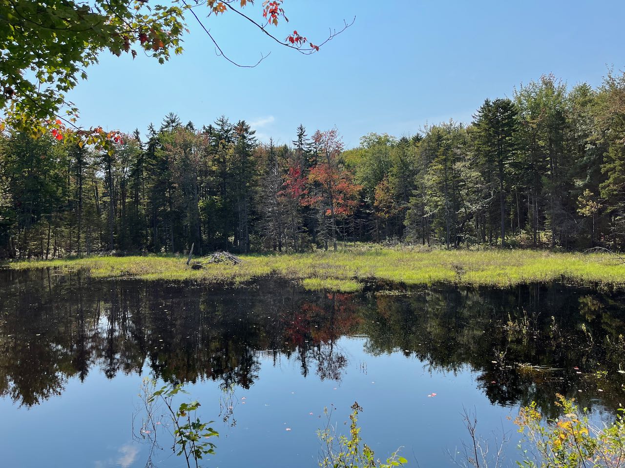
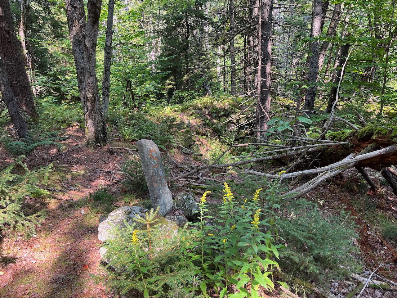
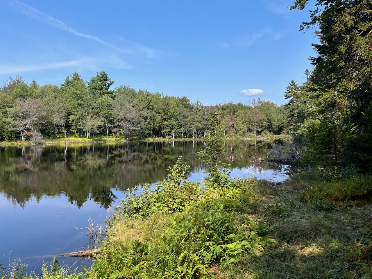
Continue on foot up King Street as it leads uphill past a few quaint cabins. At 0.2 miles, notice a few markers for the greenway and surrounding conservation land and turn right into the entrance to a grassy woods road, blocked off by a row of rocks. You are now on the Barney Brook Trail, formerly a detour off the greenway until it was rerouted to be the official track. Quickly bear right off the road onto a well-kept footpath. Despite the rather high elevation of your starting point, you will still face a fair amount of climbing to reach the summit because you now begin a nearly 300-foot descent in order to cross the valley of Barney Brook. The drop starts out gently on a fern-lined corridor, with a few log bridges conveniently placed. The down-grade becomes more aggressive, culminating in one steep pitch to reach the valley floor. Skirting by a grassy wetland, the trail crosses two branches of Barney Brook, which converge just below you into another swampy area, on wooden bridges 0.5 miles from the road. The trail follows the second branch briefly up to a little pond, and rounds the corner around the edge of the open water. In 0.15 miles, the ascent begins in earnest, passing by the face of a large boulder. After climbing steadily for 0.2 miles, the incline mellows, and the trail passes through a stand of conifers. You will soon see a colorful county line marker on a tree, step through an opening in a stone wall, and come upon a historical marker for a homestead site on the right side of the trail. After another 0.15 miles, the trail swings to the right to curl around a lower eastern summit of the hill, maintaining a steady elevation as it goes. After a quarter mile, the trail dips to cross a clear woods road. The trail to the summit continues straight ahead at a sign, but take a brief detour down the road to the right to visit a quiet pond. If you walk downhill for 0.15 miles, you will come to a point on the shore of the pond where the road was flooded. Here you can enjoy the scenery for a moment before continuing on.
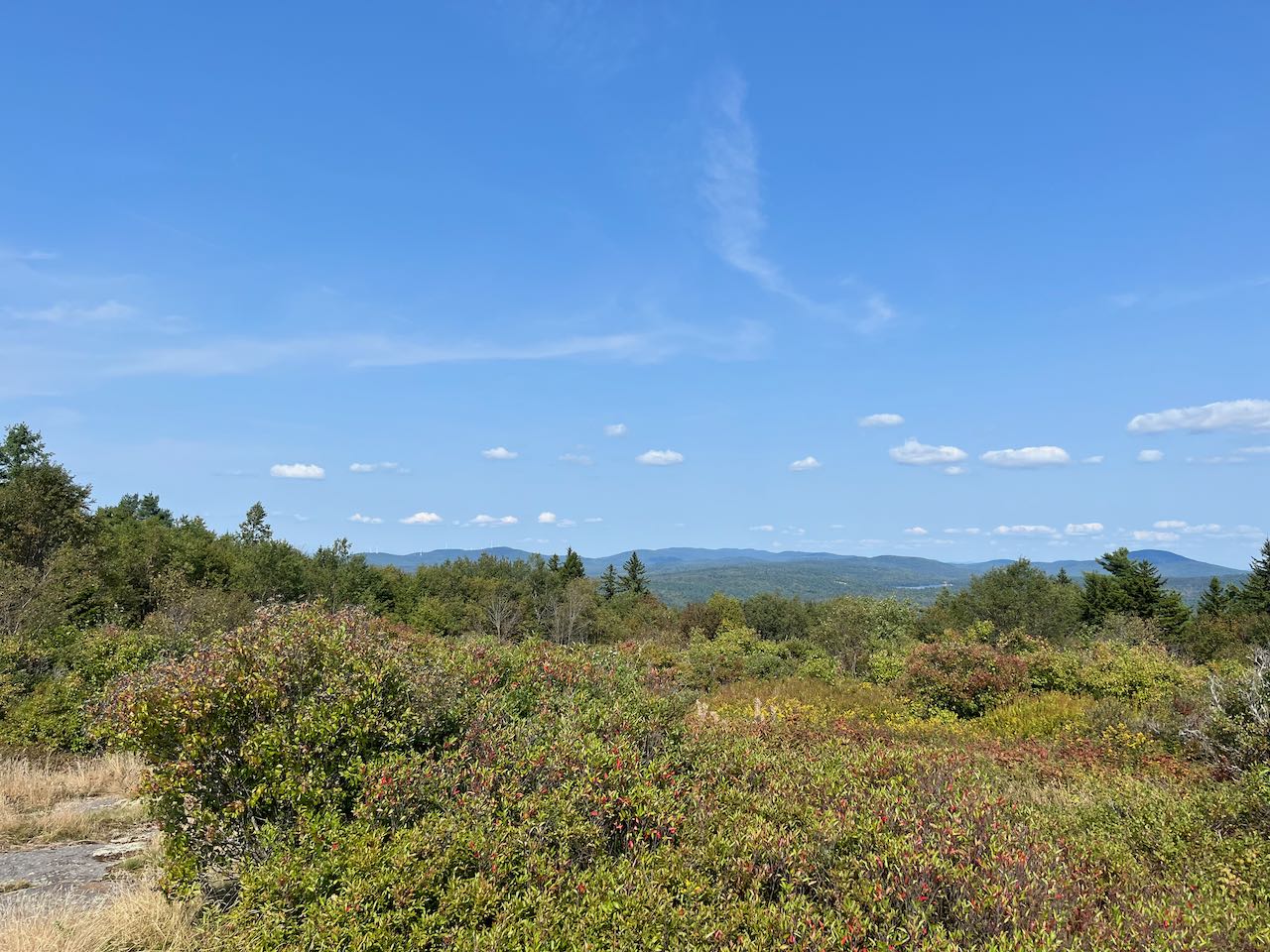
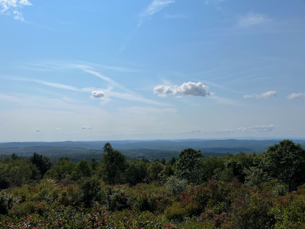
Back on the main trail, the path climbs a bank away from the road and parallels it for a moment through spruces, then swings away. The trail rises across the slope beneath the summit of the hill and climbs beyond it to the north, making a 180-degree bend back toward the clearing at a point 0.3 miles from the road, where the old now-closed route of the greenway continued north (remember to turn right at this point on the way back). Follow the trail for the last 0.15 miles across a few patches of exposed ledge into the expansive, brushy clearing. The summit is marked with a large cairn and sign. Off one side of the clearing, you can see to the northeast toward the Mt. Sunapee ridgeline, with the wind farm around Bean Mountain on its left and Lovewell Mountain on its right. In a gap between Lovewell and the extensive Rowes Hill, you can glimpse the Belknap Range. Over the trees to the southeast is nearby Pitcher Mountain. Look for the fire tower poking up from the clearing. Not far to the right is Mt. Monadnock and its small companion Gap Mountain. The most open view is off the west side, where you can gaze across the Vermont horizon and pick out many Green Mountain peaks in the distance, including famous ski area summits Mt. Snow and Stratton Mountain.
Printable directions page